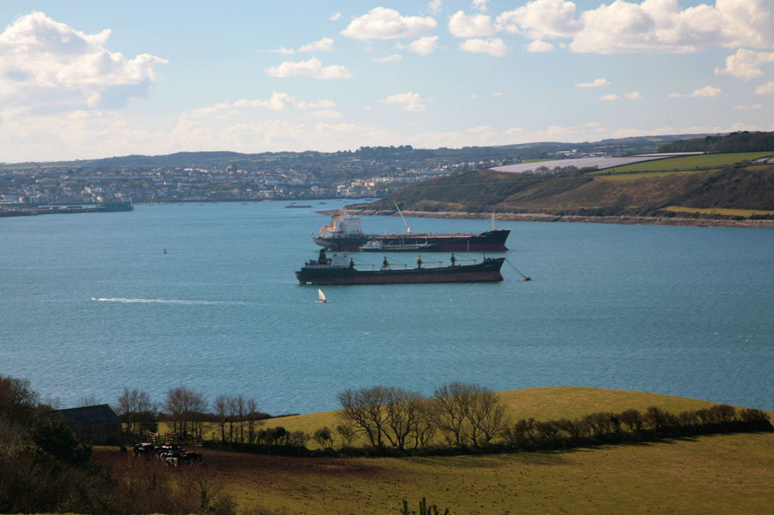
Question: Which English County has two seperate coastlines with each facing a different sea? Answer: Devon Bristol Channel and English Channel Question: Which island is separated from the British mainland by the Menai Straits? Answer: Anglesey (Ynys Môn) Question: How many counties are there in Northern Ireland? Answer: Six Antrim, Armagh, Down, Fermanagh, Londonderry & Tyrone Question: Yorkshire is clearly the largest county by area in England and the UK. But which is England’s second largest county? Answer: Lincolnshire Question: Which is the most southerly of the Channel Islands? Answer: Jersey Question: Which long-distance footpath in the UK follows approximately the Wales–England border? Answer: Offa’s Dyke Path Question: Which river forms much of the border between England and Scotland? Answer: Tweed Question: Chapel Allerton, Headingley & Horsforth are districts of which English city? Answer: Leeds Question: Which County is the largest in Scotland and the second largest in the UK? Answer: Inverness-shire Question: On a British Ordnance Survey map, what does the letters CG stand for? Answer: Cattle Grid Question: Clearwell Caves and the viewpoint of Symonds Yat are located on the edge of which forest? Answer: Forest of Dean Question: Which inlet of sea separates Cumbria in England from Dumfries & Galloway in Scotland? Answer: Solway Firth Ships Anchored in the Carrick Roads Estuary off Falmouth Harbour
Question: What is the name of the Estuary upon which the port of Falmouth is situated? Answer: Carrick Roads Answer: Bath Question: The Roman Town called Aquae Sulis is, today, which English city? Question: What is the name of the largest inland water in the UK? Answer: Lough Neagh in Northern Ireland Question: Which long-distance footpath stretches from from Edale, in the northern Derbyshire Peak District, through the Yorkshire Dales and the Northumberland National Park and ends at Kirk Yetholm, just over the Scottish border? Answer: Pennine Way Question: The largest county in Wales is the same size as the Country of Trinidad & Tobago. Which county is this? Answer: Powys Powys was created in 1974 by merging the historic counties of Montgomeryshire, Radnorshire and most of Brecknockshire. Question: Which is the biggest river in the UK when measured by the volume of water that it discharges? Answer: River Tay It is only the seventh longest river in the UK but it has the greatest discharge. Question: Which European city has the highest mileage of canals in the world? Answer: Birmingham Question: Most of southern Britain is made of various sedimentary rocks that where laid down during which prehistoric period? Answer: The Jurassic Period 199 to 145 million years ago. Question: In which UK Country are the following located:
Answer: 1. England; 2. Scotland. Although the town of Berwick gives it name to a Scottish County, the town afterwards became an English possession in 1482. Berwick is situated at the mouth of the River Tweed which forms much of the border between England and Scotland. The fact that the town is principally on the north bank of the river makes it being part of England appear even more obtuse. Question: The Great Orme is a prominent feature in which Welsh seaside town? Answer: Llandudno Question: Which area covered by the Shipping Forecast shares its name with an island in the Bristol Channel? Answer: Lundy Question: Which historic county of the Welsh Marches was until 1972 not clearly defined by Act of Parliament as being either part of England or part of Wales? Answer: Monmouthshire Hence the expression used before 1972, Wales & Monmouthshire Question: Chapel Allerton, Headingley & Horsforth are districts in which English city? Answer: Leeds 
British Geography

